

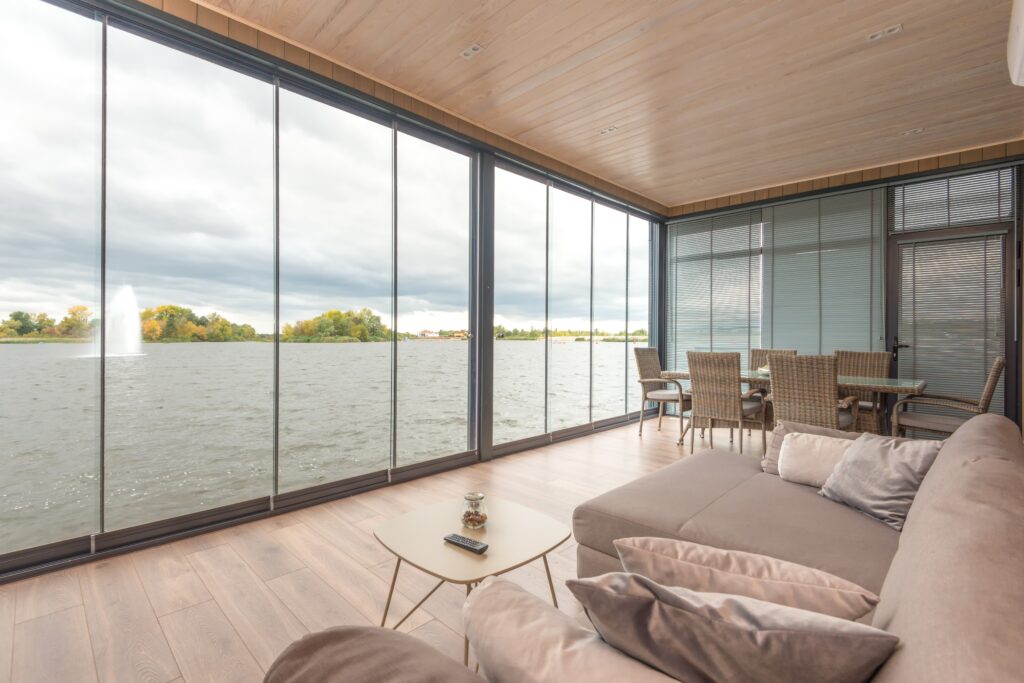
Virtual tours are becoming increasingly popular in the real estate industry, allowing potential buyers to explore properties from the comfort of their own homes. However, creating realistic 3D models that accurately capture the essence of a property is no easy task. That’s why professionals are turning to cutting-edge techniques like photogrammetry and lidar scanning to create high-quality 3D models that deliver an immersive experience to users.
In this article, we’ll explore the top 5 techniques for creating high-quality 3D models that will help you take your virtual tours to the next level. From photogrammetry to laser scanning, we’ll delve into the pros and cons of each method, and provide you with the tools you need to create stunning 3D models . So, let’s dive in and explore the world of 3D modeling!
Photogrammetry: Capturing Realism with Multiple Photographs

What is Photogrammetry?
Photogrammetry is a powerful technique that harnesses the potential of multiple photographs taken from various angles to construct a detailed, textured 3D mesh of a property. This method involves capturing a series of high-resolution images that comprehensively cover the entire space. By utilizing advanced software, these images are analyzed and common features are extracted to create a digital representation.
Through the process of triangulating the position of these features, a realistic 3D model is generated, complete with textures and intricate details. The outcome is a lifelike representation that provides users with the ability to explore the property in a manner that surpasses traditional imaging methods.
Pros of Photogrammetry
- High Level of Detail: Photogrammetry enables the creation of highly detailed 3D models by capturing a multitude of images from different angles. This level of detail allows for an immersive experience, as users can observe fine textures, intricate patterns, and small features with remarkable accuracy.
- Realism and Immersion: The textured 3D models produced by photogrammetry provide a realistic representation of the property. The inclusion of textures enhances the visual experience, making it easier for users to perceive depth, scale, and material qualities. This level of realism immerses users in a virtual environment that closely resembles the actual space.
- Cost-Effective: Compared to other methods of 3D modeling, photogrammetry can be a cost-effective solution. Instead of employing specialized equipment or conducting extensive measurements, photogrammetry primarily relies on a series of photographs. This approach reduces the need for additional equipment and minimizes the associated costs.
Cons of Photogrammetry
- Processing Time and Complexity: The process of creating a photogrammetric model involves analyzing a large number of images and extracting common features. This process can be time-consuming, especially when dealing with complex scenes or large datasets. Additionally, the software used for photogrammetry requires a certain level of technical expertise to obtain accurate and satisfactory results.
- Environmental Factors: Photogrammetry heavily relies on image capture, and environmental conditions can impact the quality of the final model. Factors such as lighting variations, weather conditions, and obstructions can introduce challenges and affect the accuracy of the reconstructed 3D model.
Tools for Photogrammetry
1. High-Resolution Camera: A high-resolution camera is essential for capturing detailed images that will be used in the photogrammetric process. The camera should have manual controls to ensure consistency in image quality and exposure settings.
2. Photogrammetry Software: Various software options are available for processing and reconstructing 3D models from photographs. Popular photogrammetry software includes Agisoft Metashape, RealityCapture, and Pix4D. These tools offer advanced algorithms for feature extraction, matching, and mesh generation.
3. Image Editing Software: In some cases, image editing software such as Adobe Photoshop or GIMP may be required to enhance or adjust individual images before feeding them into the photogrammetry software. This step can help improve the overall quality and consistency of the captured images.
4. Powerful Hardware: The computational requirements for photogrammetry can be demanding, particularly when working with large datasets. To ensure efficient processing, a powerful computer or workstation with ample RAM, a fast processor, and a capable graphics card is recommended.
By leveraging photogrammetry and utilizing the appropriate tools, individuals and organizations can create detailed, textured 3D models that provide an immersive and realistic representation of properties. While there are considerations such as processing time and environmental factors, the benefits of photogrammetry make it a valuable technique for various applications, including architecture, archaeology, virtual reality, and more.
Lidar Scanning: Precise Spatial Data for Unmatched Accuracy

Lidar scanning is a cutting-edge technique that offers precise spatial data, enabling unmatched accuracy in the creation of high-quality 3D models. By utilizing Lidar technology, this method revolutionizes the way virtual tours are conducted, elevating realism to new heights.
Now, we will delve into the advantages and disadvantages of Lidar scanning, as well as the essential tools required to leverage this technique effectively.
Pros of Lidar Scanning
- Unrivaled Accuracy: Lidar scanning provides an exceptional level of accuracy in capturing spatial data. By emitting laser pulses and measuring the time it takes for them to return after hitting objects in the environment, Lidar scanners can accurately determine the distances and positions of various surfaces. This precision results in highly accurate 3D models that closely resemble the physical space.
- Comprehensive Data Capture: Lidar scanning captures a vast amount of data, allowing for a comprehensive representation of the scanned area. It can capture detailed information about the geometry, dimensions, and even surface texture of objects and structures. This comprehensive data enables a more realistic and immersive virtual tour experience.
- Efficient and Fast: Lidar scanners can quickly collect data over large areas in a relatively short amount of time. Compared to traditional methods such as manual measurements or photogrammetry, Lidar scanning significantly reduces the time required for data acquisition. This efficiency makes it suitable for capturing data in time-sensitive projects or environments where minimal disruption is desired.
Cons of Lidar Scanning
- Costly Equipment: Lidar scanning requires specialized equipment, including laser scanners and associated hardware, which can be expensive to purchase or rent. The initial investment in acquiring the necessary hardware and software can be a barrier for individuals or small organizations.
- Limited Color and Texture Information: While Lidar scanning excels at capturing geometric data, it has limitations when it comes to capturing color and texture details. The laser pulses used in the scanning process are primarily focused on determining distances, which means that capturing high-resolution color and texture information may require additional methods such as photogrammetry.
Tools for Lidar Scanning
- Lidar Scanner: The central tool for Lidar scanning is a Lidar scanner, which emits laser pulses and captures the reflected signals to measure distances and create a point cloud of the scanned area. Popular Lidar scanner manufacturers include Leica Geosystems, Trimble, and Faro. Choosing the appropriate scanner depends on factors such as range, accuracy, and budget.
- GNSS Receiver: Global Navigation Satellite System (GNSS) receivers are used in conjunction with Lidar scanners to accurately determine the position and orientation of the scanner. This information helps in aligning and georeferencing the captured data with other spatial datasets.
- Processing Software: Lidar scanning generates vast amounts of point cloud data that need to be processed and transformed into a usable 3D model. Software applications such as Autodesk ReCap, Leica Cyclone, and Bentley Pointools are commonly used for processing and analyzing Lidar data.
- Workstation with Ample Processing Power: Due to the large volume of data generated by Lidar scanning, a powerful workstation with sufficient processing power, ample storage, and high-performance graphics capabilities is essential for efficient data processing and visualization.
Incorporating Lidar scanning into the workflow for creating high-quality 3D models can significantly enhance the realism and accuracy of virtual tours. Despite the initial costs and limitations in color and texture capture, the unparalleled precision and efficiency offered by Lidar scanning make it a valuable technique
Structured Light Scanning: Detailing Surfaces with Projected Patterns

Structured light scanning is a sophisticated technique that allows for the detailed capture of surfaces by projecting patterns onto objects. This method utilizes the principles of triangulation to create precise 3D models with intricate surface details. In this section, we will explore the key features, advantages, and tools associated with structured light scanning.
Key Features of Structured Light Scanning
Structured light scanning relies on the projection of a known pattern onto the surface of an object. The pattern can take various forms, such as grids, stripes, or random dots. As the pattern is projected onto the object, a camera captures the deformed pattern on the surface, allowing for the extraction of 3D data. The distortions observed in the captured pattern are then analyzed to reconstruct the geometry of the object.
Advantages of Structured Light Scanning
- High Accuracy: Structured light scanning offers a high level of accuracy in capturing surface details. The precise projection of patterns and the analysis of distortions enable the measurement of subtle variations in the object’s geometry. This accuracy is particularly valuable in industries such as manufacturing, product design, and quality control, where precise measurements are critical.
- Fast Data Acquisition: Structured light scanning allows for rapid data acquisition, making it suitable for applications that require efficiency and quick turnaround times. By projecting patterns and capturing the resulting deformations, the process can rapidly generate a dense point cloud or a full 3D model. This speed is advantageous in industries where time-sensitive projects are common.
- Versatile Applications: Structured light scanning finds applications in various fields, including industrial design, reverse engineering, cultural heritage preservation, and medical imaging. Its ability to capture fine details and intricate surfaces makes it well-suited for tasks such as capturing the shape of objects, digitizing sculptures or artifacts, and creating custom-fit prosthetics or orthotics.
Tools for Structured Light Scanning
- Projector: A high-quality projector is a fundamental tool for structured light scanning. It is responsible for projecting the predefined pattern onto the object’s surface. The choice of projector depends on factors such as resolution, brightness, and the desired size of the scanned area.
- Camera: A high-resolution camera is necessary for capturing the deformed patterns on the object’s surface. The camera should be capable of capturing images with sufficient detail and precision. In some cases, multiple cameras may be used to capture different perspectives simultaneously.
- Software: Specialized software is essential for processing the captured images and generating the 3D models. Popular software solutions for structured light scanning include 3D scanning software like DAVID-Laserscanner, Photomodeler, and Meshroom. These tools provide algorithms for pattern analysis, 3D reconstruction, and post-processing of the acquired data.
- Calibration Tools: Calibration tools, such as calibration panels or calibration targets, are used to ensure accurate measurements and alignment between the projector and the camera. These tools help eliminate distortion and improve the accuracy of the structured light scanning system.
Structured light scanning offers a powerful method for capturing detailed surface information with accuracy and efficiency. By projecting patterns onto objects and analyzing the resulting distortions, this technique enables the creation of high-quality 3D models suitable for a wide range of applications.
With the right tools and software, structured light scanning can revolutionize industries requiring precise surface measurements and intricate geometric data.
Time-of-Flight (ToF) Sensors: Fast and Accurate Depth Measurements

Time-of-Flight (ToF) sensors utilize the principle of measuring the time it takes for light to travel to and from an object to determine its distance. These sensors emit light pulses and measure the time it takes for the pulses to reflect back from different points in the environment. By analyzing the reflected light, the sensor can calculate the depth information for each point, generating a point cloud representation of the property.
ToF sensors are known for their speed and accuracy, making them suitable for capturing dynamic environments and moving objects. This method is commonly used in applications such as real-time 3D scanning, augmented reality, and gaming, where fast and precise depth measurements are crucial.
Key Features of Time-of-Flight Sensors
Time-of-Flight sensors operate by emitting a light signal, such as an infrared laser or an LED, and measuring the time it takes for the signal to return after reflecting off an object. This time measurement is then used to calculate the distance between the sensor and the object.
ToF sensors can capture depth information for individual points or generate a depth map of an entire scene, facilitating the creation of 3D models.
Advantages of Time-of-Flight Sensors
- Fast and Real-Time Measurements: Time-of-Flight sensors offer fast depth measurements, making them ideal for applications that require real-time data processing. The speed of light allows ToF sensors to capture depth information rapidly, enabling quick responses in dynamic environments. This advantage is valuable in fields such as robotics, augmented reality, and autonomous vehicles.
- Robust Performance: ToF sensors can function reliably across different lighting conditions, including low-light environments. They are less affected by ambient light or external factors compared to other depth sensing technologies, ensuring consistent performance and accuracy in various settings.
- Wide Range of Applications: Time-of-Flight sensors are available in compact sizes, making them suitable for integration into small devices or systems. Additionally, advancements in technology have made ToF sensors more affordable, enabling wider accessibility for individuals and organizations.
Tools for Time-of-Flight Sensors
- Time-of-Flight Sensor: The central tool for utilizing ToF technology is a Time-of-Flight sensor. These sensors can be integrated into various devices, including cameras, smartphones, and robotics platforms. Some well-known Time-of-Flight sensor manufacturers include Texas Instruments, STMicroelectronics, and Infineon Technologies.
- Software Development Kits (SDKs): Many Time-of-Flight sensor manufacturers provide SDKs that include software libraries and APIs, allowing developers to access and process the depth data captured by the sensor. These SDKs often offer functionalities for noise reduction, depth mapping, and integration with existing software platforms.
- Calibration Tools: To ensure accurate depth measurements, calibration tools are used to align and calibrate the Time-of-Flight sensor. These tools help compensate for any potential errors or distortions in the depth data, resulting in more precise measurements.
- Processing Hardware: Depending on the application, a suitable hardware platform is required to process the depth data captured by the Time-of-Flight sensor. This can range from embedded systems with sufficient computational power to high-performance workstations for more complex data analysis and visualization.
Time-of-Flight (ToF) sensors offer fast and accurate depth measurements, making them invaluable in applications that require real-time 3D scanning and precise distance calculations. With their versatility, reliability, and cost-effectiveness, ToF sensors continue to drive advancements in fields such as augmented reality, gaming, robotics, and industrial automation, pushing the boundaries of immersive experiences and technological innovation.
Multi-View Stereo (MVS): Constructing 3D Models from Multiple Images
Multi-View Stereo (MVS) is a powerful technique for creating high-quality 3D virtual tours by utilizing multiple images of a property taken from different viewpoints. This approach involves identifying common features across the images and determining their corresponding 3D positions.
By analyzing the parallax between different viewpoints, the software can triangulate the depth information for each point, resulting in a dense and realistic 3D representation of the property. MVS is widely recognized as one of the best techniques for creating immersive virtual tours, offering a range of benefits that enhance the visual experience.
Benefits of Multi-View Stereo (MVS) for Virtual Tours
- Highly Detailed and Accurate Models: MVS excels in capturing fine details and accurately representing the geometry of the property. By leveraging multiple images from different viewpoints, this technique provides a comprehensive and precise 3D model. This level of detail enhances the realism of virtual tours, allowing users to explore the property with a heightened sense of immersion.
- Wide Coverage and Large-Scale Environments: MVS is effective in capturing large-scale environments, making it suitable for virtual tours of expansive properties or outdoor areas. By incorporating multiple viewpoints, the technique ensures comprehensive coverage and enables the creation of seamless and immersive virtual experiences.
- Flexibility in Image Acquisition: MVS allows for flexibility in image acquisition, as it can utilize images captured with various types of cameras and from different angles. This versatility makes it easier to integrate MVS into existing workflows and adapt to specific project requirements. Additionally, the availability of images from multiple sources enhances the chances of capturing diverse perspectives and optimizing the 3D reconstruction process.
- Widely Used in Various Applications: MVS has found extensive application in the field of virtual reality, cultural heritage digitization, architectural visualization, and more. Its ability to generate highly detailed and accurate 3D models has made it a preferred choice for creating immersive virtual tours that showcase architectural designs, historical sites, and cultural artifacts.
Software and Tools for Multi-View Stereo (MVS)
- MVS Software Packages: Several software packages are available for performing MVS, including Meshroom, RealityCapture, and PhotoScan. These software solutions offer advanced algorithms for feature matching, depth estimation, and 3D reconstruction, streamlining the MVS workflow and generating high-quality 3D models.
- High-Quality Cameras: To capture images for MVS, high-quality cameras capable of capturing detailed and high-resolution images are recommended. DSLR cameras or professional-grade mirrorless cameras are often used to ensure optimal image quality and color reproduction.
- Image Alignment Tools: Image alignment tools help to ensure accurate alignment and calibration of the captured images. These tools aid in minimizing errors in camera position and orientation, improving the overall accuracy of the MVS process.
- Powerful Computing Resources: MVS involves intensive computational tasks, requiring a powerful workstation or dedicated server with ample processing power and memory. This ensures efficient processing and reconstruction of 3D models from the multiple images.
Conclusion
The use of advanced techniques such as photogrammetry and lidar scanning is key to generating high-quality 3D models for virtual tours. Through photogrammetry, multiple photographs are transformed into textured 3D meshes, while lidar scanning captures precise spatial data for unmatched accuracy. These techniques elevate the realism of virtual tours, enabling users to experience properties as if they were physically present.
In addition to photogrammetry and lidar scanning, several other advanced techniques contribute to the creation of high-quality 3D models for virtual tours. Structured light scanning utilizes projected patterns to detail surfaces, while time-of-flight sensors provide fast and accurate depth measurements. Multi-view stereo leverages multiple images to construct 3D models. Each method offers unique capabilities and benefits, allowing for the creation of realistic and immersive virtual tours.
The continued advancement and integration of these techniques drive innovation in the real estate industry, revolutionizing property viewing experiences for potential buyers.